
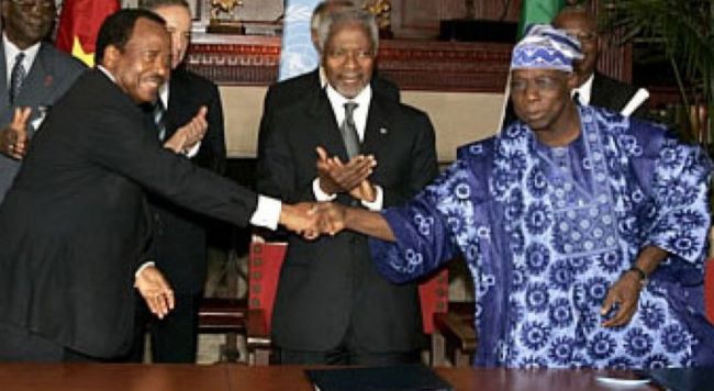
Cameroon, Nigeria near completion of 2,100km border demarcation
Nearly 24 years after the International Court of Justice resolved the Nigeria-Cameroon boundary dispute, both countries are expected to complete the physical demarcation of their 2,100-kilometre international border before the end of the year.
The Director-General of the National Boundary Commission, Adamu Adaji, disclosed this in an interview with the News Agency of Nigeria in Abuja.
Adaji said the remaining work is concentrated in the Adamawa sector, where more than 260 boundary pillars are being installed to make the border clearly visible on the ground.
He said the work is expected to be completed within the next two or three months, after which attention will shift to managing the needs of communities affected by the boundary.
“Hopefully, before the end of the year, we should be done with the demarcation,” Adaji said.
The International Court of Justice delivered its judgment on the Nigeria-Cameroon land and maritime boundary dispute on Oct. 10, 2002, awarding sovereignty over the Bakassi Peninsula to Cameroon and defining the countries’ land and maritime boundaries.
Implementation of the judgment began after Nigeria and Cameroon agreed, under United Nations auspices, to establish the Nigeria-Cameroon Mixed Commission to address outstanding issues.
Adaji said some areas had remained unresolved because the boundary alignment affected communities with longstanding cultural, linguistic and historical ties across both sides.
He said those disagreements had since been resolved through discussions between the two countries, with adjustments made in some areas to take the interests of affected populations into account.
One example, he said, is Koja, a predominantly Nigerian settlement that was initially placed largely on the Cameroonian side by the ICJ-defined boundary.
According to Adaji, an agreement between both countries allowed the entire community to remain in Nigeria, while other concessions were made elsewhere.
He said the approach was intended to promote lasting peace and cooperation along the border.
Adaji said the next phase after physical demarcation would focus on development and the provision of basic services to affected communities.
He said the NBC had assessed the needs of communities along the boundary and was working with the United Nations to improve their conditions, subject to support from international partners and the governments of both countries.
The Nigeria-Cameroon boundary is Nigeria’s longest international land boundary, stretching about 2,100 kilometres from the Chad Basin through the states bordering Cameroon to the Atlantic coast.
Nigeria also shares land boundaries of about 770 kilometres with Benin and 1,500 kilometres with Niger, according to the NBC.
Adaji said cross-border cooperation would remain important even after demarcation because communities on both sides of the boundary often have close social and economic ties.
He said the NBC had established an ECOWAS platform for cross-border cooperation, alongside local committees involving states and neighbouring communities.
The initiatives, he said, would support information sharing, help combat smuggling and irregular migration, and allow legitimate cross-border movement to be properly documented.
On maritime boundaries, Adaji said Nigeria’s boundaries in the Gulf of Guinea involve Equatorial Guinea, Cameroon, Ghana and Benin.
He said Nigeria’s maritime boundary with Cameroon had been resolved, while negotiations were continuing over about three nautical miles with Equatorial Guinea and about eight nautical miles with Ghana.
The maritime boundary with Benin, he said, had been defined by treaty.
Adaji said the NBC was working to properly define Nigeria’s maritime boundaries and establish coordinates that would guide naval operations and shipping activities.
Culled from Nigeriainfo


